Sixteen months later,Google Mapsmay finally have found a way to lure me back underground.
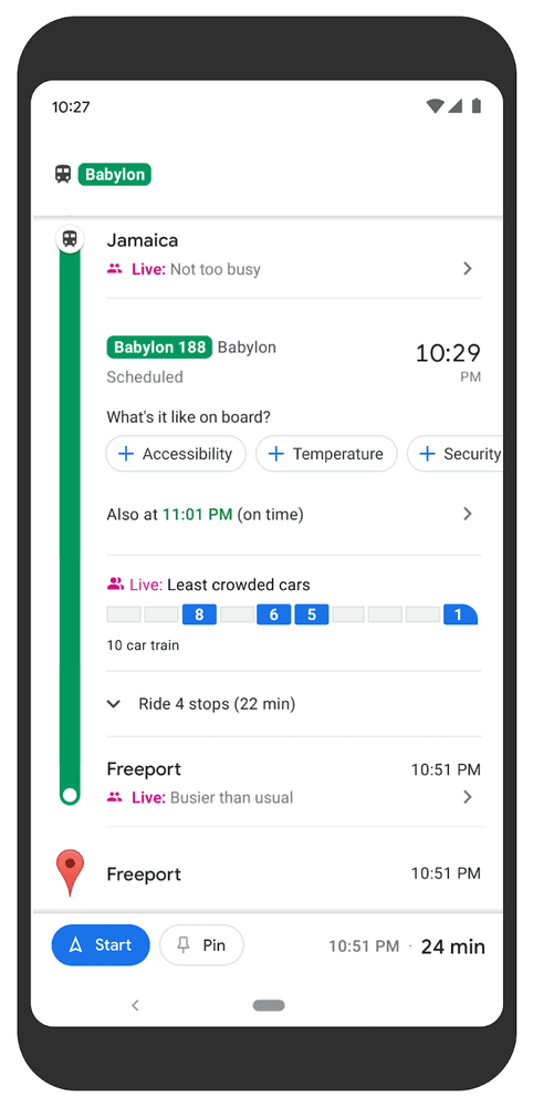
The service is now piloting the option to see live data on the crowdedness ofindividual train carriages.
It’s free, every week, in your inbox.

The predictions have now been expanded from nearly 200 cities to more than 10,000 transit agencies in 100 countries.
The new data is currently available in New York and Sydney.
Google says more cities are coming soon.

Quick take:The drive to get people back into offices is making many public transport systems busy again.
Crowdedness predictions can make the experience less painful, whether youre worried about COVID or just hate jam-packed carriages.
Story byThomas Macaulay
Thomas is the managing editor of TNW.
He leads our coverage of European tech and oversees our talented team of writers.
Away from work, he e(show all)Thomas is the managing editor of TNW.
He leads our coverage of European tech and oversees our talented team of writers.
Away from work, he enjoys playing chess (badly) and the guitar (even worse).
