The eruption is the fourth and largest to hit the region since December.
It has forced some 3,800 residents from the nearby town of Grindavik to evacuate.
Many have said they have no plans to return.
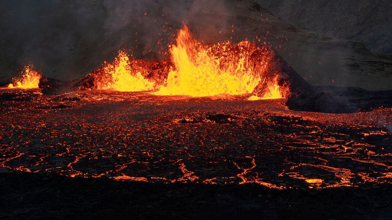
Another view of when the#eruptionstarted a short while ago in#Iceland.
The ground just opens up and boom!
Just amazing!!!
40% off TNW Conference!
But newer technologies are emerging that could deepen our insights even further.
Satellites, drones, andAIcan improve the accuracy of predictions and help us monitor their impacts.
Eyes in the skies
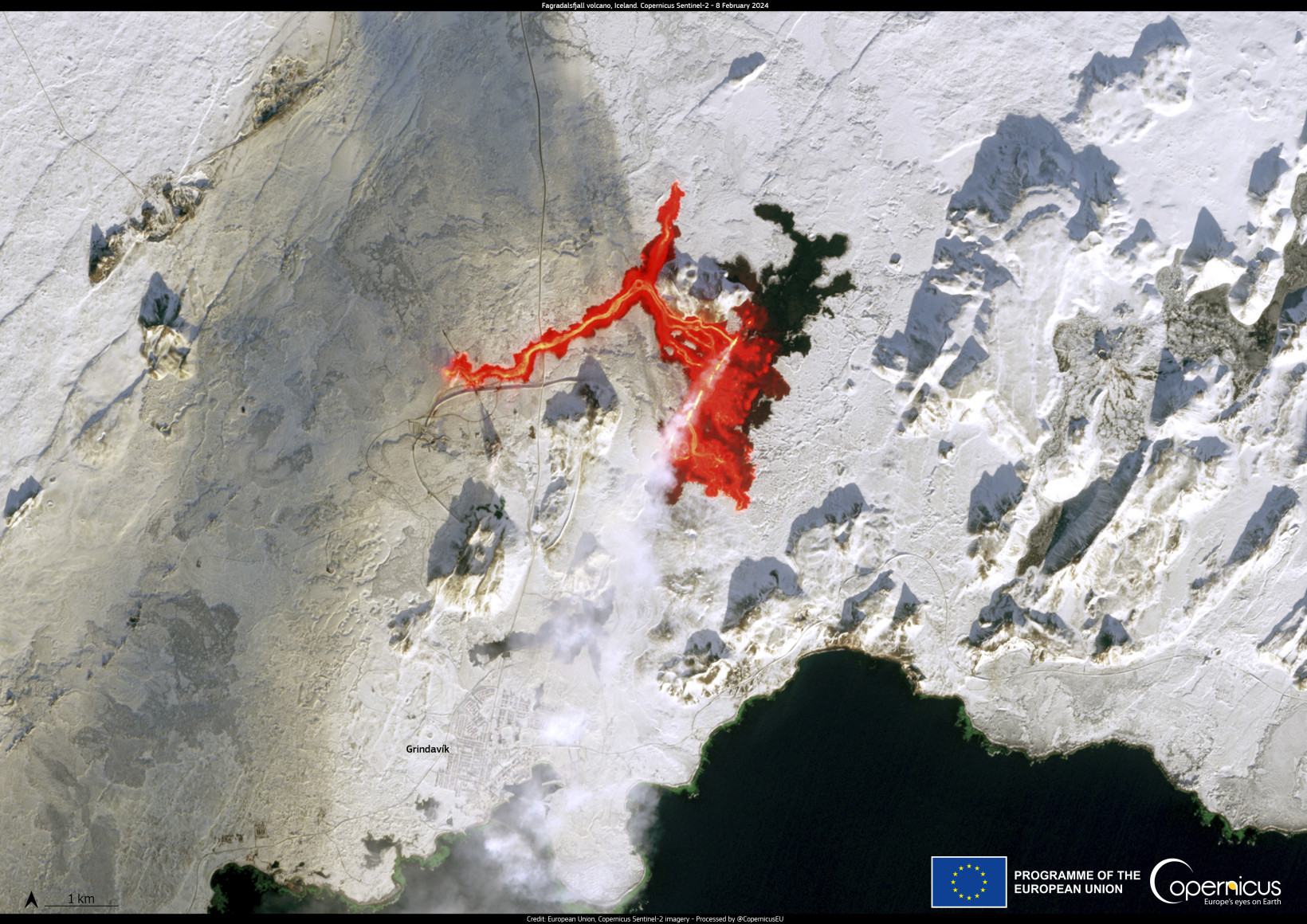
Satellites flying above us provide a wealth of real-time data on volcanic activity.
The EUsCopernicus Sentinel-1 satellites are used across the world by volcanologists to predict eruptions.
This tool could potentially provide an early warning system.

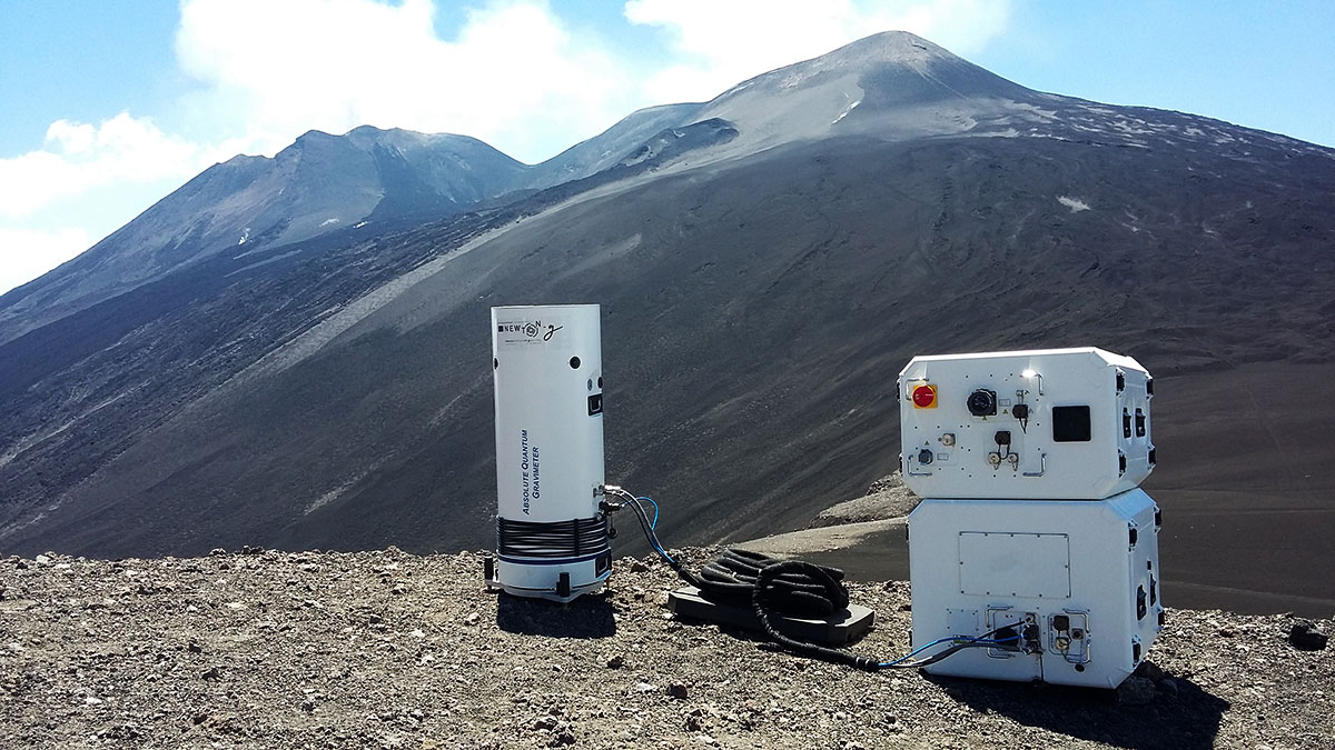
In 2021, an EU-backedprojectinstalled a first-of-its-kindquantumgravimeter on the slopes of Mount Etna Europes most active volcano.
Researchers are also working on gravimetrysatellites that detect changes in gravity from space, Ourevitch told me.
Heres where machines come in handy.
The algorithm sorted through the images, flagging sixteen that showed deformation, an early precursor for an eruption.
Also in Italy, ESA is tapping another technology drones.
Who knows, maybe in the near future volcano tech will become the next hottest technology trend.
However,Copernicus is the Earth observation component of the European Union Space Programme.
Story bySion Geschwindt
Sion is a freelance science and technology reporter, specialising in climate and energy.
